|
Stawamus Chief - Distance : 6 km.Elevation gain : 500 m. High point : 610 m. Time : 6 hrs. This is one of my favourites
. I find it a wonderful work out for legs & lungs . Drive to the parking lot at Shannon Falls
early , this trail can
get busy on a weekend , or try it on a week day . Be ready for a steady climb and pay attention to the sign at the trail head
. This is not a trail to hike on in the rain due to the large number of
roots and rocks on the trail . I find the 2nd.
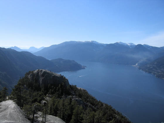
peak a bit more of a challenge , you are also some 165 m. higher than the first peak . The view up Howe Sound is a welcome
sight once on top . Most comments on the Chief are a simple " WOW " ... nuff said ! It's a great hike
on a summer day , with big rewards for little work. Note parking at the trail head will cost you $3 for the day.

|
| Click for larger view |

|
| Click for larger view |
|
|
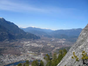
This is the view of downtown Squamish as seen from the second Peak.
Whistler is at the head of the valley.
Stawamus Chief - Dogs
B.C. Parks asks that we pass on a reminder that dogs must be on leash at all times
in provincial parks, including all areas of Stawamus Chief Provincial Park. The only exception to this is the Chief backside
trail, where dogs may be off-leash, but must still be under close control. There have been incidents with off leash and/or
aggressive dogs, as well as concerns about dog poop. As there are over 90,000 annual user days on the Chief trail, we suggest
that picking up after your dog on the trail would be a considerate thing to do.
High Falls Creek
High Falls Creek : Distance 6 km. One way Elevation: 725 m. Elevation gain : 640 m . Time : 4 hours. To
get to this scenic hike , drive passed Squamish toward Alice Lake . Turn left at Alice Lake on the Squamish Valley Road .
The road veers left after you cross a cement bridge . The trail head is 27 km. from highway 99 , the last 3 is on a good gravel
road . You will pass a Power House on your right side and the parking is 1 km. Passed here . Go across the creek and the trail
is marked by a small wooden sign . The trail starts out fairly easy but not for long . This is not a hike for the kids or
if you bring a dog . The climbing is steady and steep , there is also an extremely deep canyon that ,at times , you are very
close to . There are 5 braided ropes on the trail to help you up the steep parts .On your way up you will be scrambling over
moss covered bluffs . The views of the Tantalus range and the Squamish River below will take your breath away . The
first
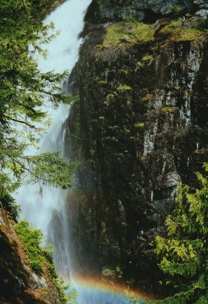
view point is 15 minutes from the start of the trail . At the 1 km. Point you get your first view of the falls , this is a
good spot to stop for a quick water break . Ascend the next bluff using the handholds and at the 2 km. point there is a sign
" View Point . No exit " . This side trail only takes 5 minutes and will give you a close up view of the falls . It is also
the coolest spot on the trail if it is a hot day . Once back on the main trail there is another rocky bluff and a braided
rope to help you up . Climbing up another gully for
about 10 more minutes will bring you to a huge bluff top and an even
better view of the valley below . This is a great place for lunch and a well deserved rest . The hardest part of the trail
is now behind you . Back on the main trail you head northwest and enter into mature forest of Douglas fir .The change from
rocky bluffs to cool forest is a welcome one .Continue up a small slope and you emerge on High Falls Forest Service Road .
If you do not want to climb back down , turn left on the road for more views of the valley and a walk of 1.5 km back to your
car . Rating: 3 View: 3
 Vancouver Hiking
|