Mount Cheam , Distance : 9.5 km.( 5.9
miles) Elevation gain 665 m ( 2175 ft ) Total Elevation : 2112m ( 6929 ft )
After having done The Lions,
this one should be on your must do list . The views from here of the Fraser Valley
are spectacular.
To get there take Highway 1 east and get off at the Cultus lake exit. Drive
through Sardis to the Vedder Crossing
Bridge. Cross the bridge and turn right onto Chilliwack
river road. As you approach the 28km mark look for the Ford Mountain Correctional Camp to your left. The Foley Creek Forest
Service Road is just a few meters past here and this is your turn off. After 2km turn left at the T- junction , about another
2km will bring you to the Chipmunk Creek bridge.Just passed the bridge turn right up the hill. Keep right as you head on to
a steeper section all the way to the parking lot. The last part of the road is a bit of an adventure if you have a small car
like mine, but if you go slowly you should make it fine. A pick-up or 4x4 would be better if there has been some rain.
I arrived at the parking lot
with a bit of trepidation, the view across the valley was very inviting however the peaks about were shrouded in clouds. The
trail starts at the end of the parking lot and takes you onto a wide logging road. 15-20 minutes later you arrive at the meadows.
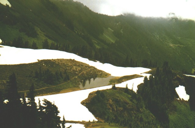
It was at the end of July and there was still a few pockets on snow on the ground, but for the most part the trail was dry.
Once across the meadow you start up hill. This part is easer than it looks; the lush greenery and alpine flowers take your
mind off the climb up to Spoon Lake.
There was a cool breeze coming up from the valley floor so the bloodsuckers were not to be seen, this made things even better.
Spoon Lake, true to its name, looks exactly
just that a big table spoon. There is a large rock right beside the trail at the lake and a perfect spot to take a water break
and reflect on the rest of your climb up. From this vantage spot you can see the trail as it zigzags up the hillside. It was
here that I wondered if things were going to improve. The peak was still covered in clouds and there were the remnants of
a camping spot at the lake. Did someone else camp here to wait for Clouds to part? From this point you have an hour to an hour and a half to the top. The trail switchbacks
on the alpine ridge several times before you hit some rocky ground.
I met up with six people who were
on their way down from the top. I asked why they were leaving so early (it was only noon).
They told me that it was very cool up at the top and completely fogged in. I told them not to worry. I was "The Hiker" and
had put in a call to the Big Guy to part the clouds. They smiled that all knowing smile, told me I had a lot of faith, wished
me a pleasant trip, and left laughing.... Unbelievers !
I was at the start of the gravel section and was told by them that it was only
about ½ hour more to go. There was a bit of blue sky behind me but I must admit it did not look to promising.
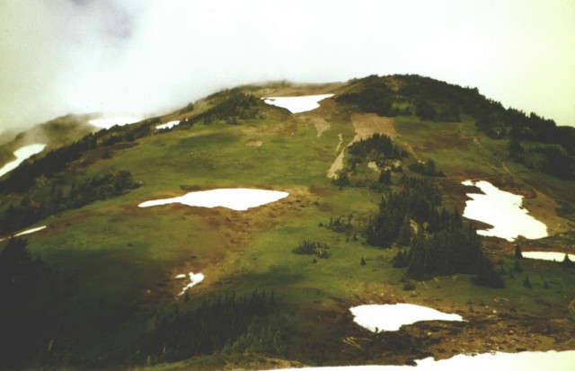
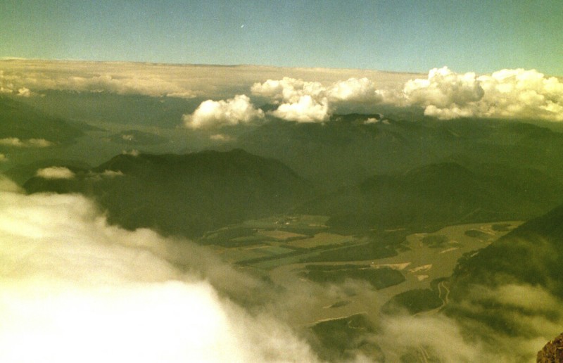
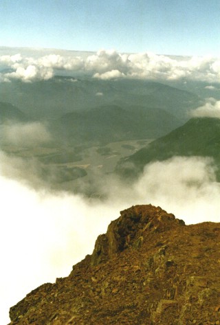
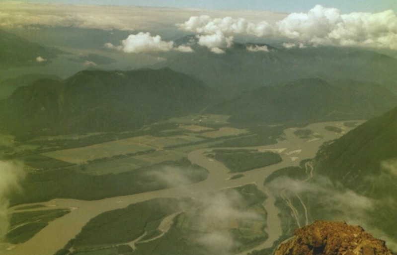
At the top there was a good breeze
blowing which quickly dried my sweat soaked shirt. I put on some fleece and decided it was time for lunch and maybe a quick
trip back down. Just as I pulled out my snack the sun came out ... Ha! To the Unbelievers. With each passing moment the valley
below was revealed. Below me and to the right the Coast Range
and Ross Lake nestled like some blue
jewel in a sea of green. Chilliwack and Harrison
Lake were directly in front of me. To the west Vancouver
and the smog. It was a hard place to leave.
Rating : 2 - 2 ½ View
: 3+