|
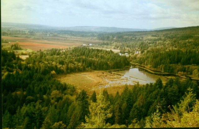
Colony Farm
9km of hiking trails not counting the PoCo trail which hooks up
at both ends of the park. This is a personal favourite of mine because it is close to where I live. I have heard there are
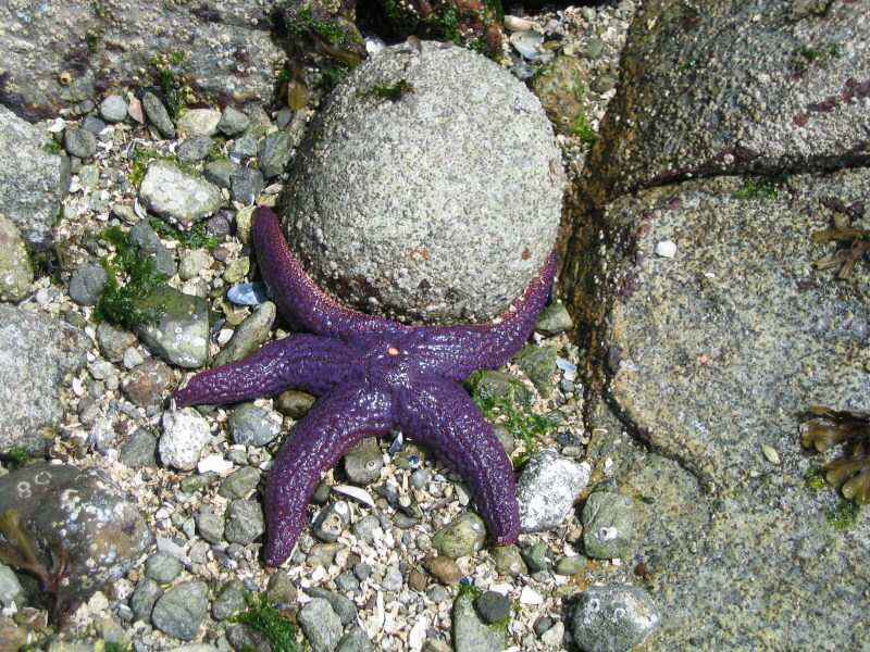
about 300 coyotes that live in the immediate area. They also have river otters (when the salmon are spawning) herons, hawks,
ducks to name but a few. Bird watchers should love the place. You should note that a few times last year bear & cougar
were sighted in the area. The G.V.R.D. will post signs to warn you when this is a concern. Because of the healthy coyote population
it is best to keep small dogs on a leash.
This is a great place to bring your mountain bike for some easy
dike riding. The PoCo. Trail will take you across Maryhill and you can follow the Fraser river all the way to the Pitt-River
Bridge, from there you can head
on to Minnekhada Park or into the Pitt-Addington
Marsh. If you elect to go North of Colony Farm on the PoCo Trail it will take you all the way alone the Coquitlam River to the foot of Burke Ridge .The trail from
Shaugnessy to Lougheed Hwy
is paved and you may even see me on my roller blades on that section.
How to get there: Travel east on Hwy 1 , take the Cape Horn exit
to Hwy 7 ( Lougheed ) Turn Right at Colony Farm road , go to the end of the road for parking . Other access is a small parking
lot just over the Red Bridge on Shaugnessy
St. If you are on the Maryhill bypass there is a small parking lot at
the south end of Shaugnessy ( 1st set of lights on Maryhill bypass , just past the Port Mann Bridge )
|
|
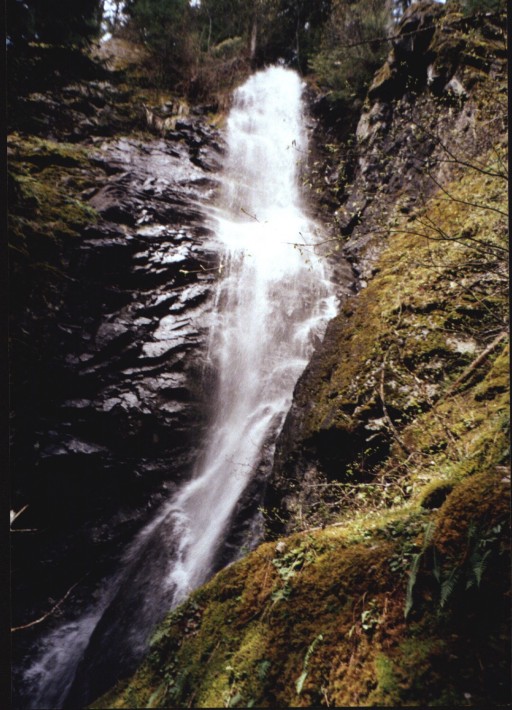
| Coquitlam River - Colony Farm |
Iona Beach:
Want to try something a bit different? Too hot for a hike up the North Shore, or is the rain coming down and making you blue? Which ever way you feel youll like this one. Make sure you bring
a pair of binoculars. The birding is good (137 bird species have been sighted) and depending on the time of year you might
be able to see Sea Lions, Harbour Seals, or Whales.
The Iona and North
Arm Jetties will take you out to the ocean for the view.
The Iona jetty is
4 km long and is perfect for walking or biking. The concrete path is on top of a sewage discharge pipe (after it has been
treated) and even has a covered bench about half way to let you get out of the wet stuff if you need to. There is a viewing
platform at the end that gives one a great place to set up a tripod for those sunset pictures over the water.
The North Arm jetty is a little less refined. This takes walkers
on a 6km trip to explore the sandy beaches. All this and the backdrop of the North Shore
Mountains add to the beauty
of this walk. Once you are at the bathrooms head off to the right and follow the beach until you come to the breakwater.
There is a good sized parking lot at the start of both places
and picnic tables for a romantic early evening snack.
If you have energy to burn you can park your car at the east end
of the Vancouver Airport and blade or
cycle to Iona. This will add 11 km to your trip. You will find lots of parking
near the fence and the shoulders are wide with not much traffic.
How to get there: Head out to the Vancouver
Airport, Main Terminal. At the first set of traffic lights on Grant
McConache Way , trun right on Templeton Street. Follow
the signs to the Treatment Plant, bear left and keep following the road to the parking lot and bathrooms.
|
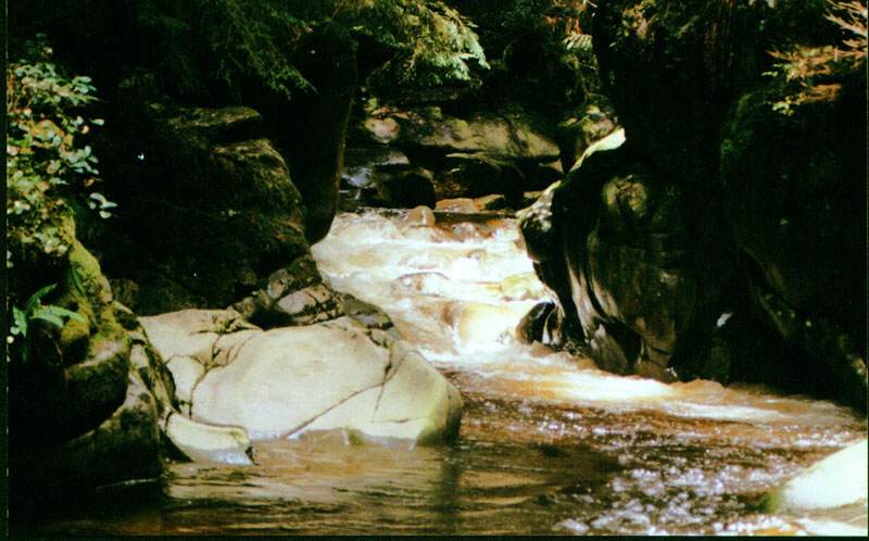
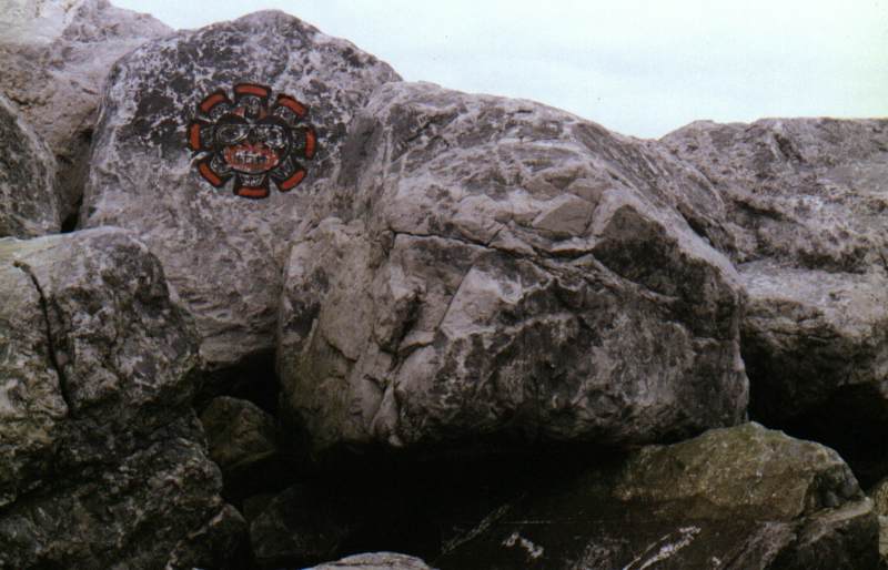
| Present day Pictograph ? |
Minnekhada Regional Park
Minnekhada Regional Park:
Distance: Trail Dependant Elevation Gain: 0- 150m
There are several trails in the park to chose from to give you
a choice of wildlife viewing at the marsh or a beautiful view of marsh, Pitt River and the surrounding area;
Lodge Trail 20-30 minutes
Fern Trail to Addington Lookout 30-45 minutes
Minnekhada Perimeter Trail 1.5-2.5 hours
Low Knoll 40 50 minutes (one way)
High Knoll 1 1.5 hours (one way)
To get there: Take
the Lougheed Highway east out through Coquitlam, then Port
Coquitlam. At Port Coquitlam,
turn left on to Coast Meridian Road and follow it north, until Appel Drive. Take Appel Drive, until it turns
to Victoria Drive. Follow
Victoria Drive to Minnekhada
Regional Park.
This 175 hectare park located in the northeast corner of Coquitlam
features trails, picnic facilities, rock knolls, lots of cedar and fir trees, birds and other wildlife, Pitt-Addington Marsh,
Minnekhada Farm, and Minnekhada Lodge. Minnekhada Lodge was built as a country
retreat for hunting in 1934 by Lieutenant Governor Eric Hamber (and apparently Queen Elizabeth stayed there at one time). The lodge is open for viewing from 1 pm
to 4 pm the first Sunday of the each month (except January).
I have lived in the area for a couple of years and this was my first time here. I was pleasantly surprised
to find this little gem tucked away in a quite corner of Coquitlam.I understand that
they have had problems in the past with break-ins to cars so leave any valuables out of sight in your trunk. I parked at the
Quarry Road entrance on a weekday and found a dozen cars already in the
lot. The trails are well marked and should be a joy to those with young kids who want to go exploring.
I decided to make
for the Low Knoll and then further on to the High Knoll to take on the views incase the weather turned bad and the clouds
moved in. Going down the Meadow Trail I was impressed with the beauty and silence of the trail. Pine needles underfoot, leaves
turning gold , the warm sun breaking through the trees. As I neared the start
of the marsh I thought about the sign at the trail head Bears sighted in Area. I was just about to dig out my bells when I
heard a number of high pitched voices from the woods. Fourteen little munchkins from a grade four class popped out of the
bush in front of me, all giggling and with very big smiles. They stopped to warn me about the big blue heron and the giant
frog they had seen at the marsh. I was tempted to tell them about the dragon that lives in the woods but thought better of
it! I was now sure that any self respecting bear was long gone after all that commotion. God
bless teachers ! Along the way there are a few old growth trees to remind you of what the area must have been like before
the logging of the 30s and 40s . The trail itself is a gentle one with only a short 5 minute moderate climb to the Low Knoll.
The view here is nice and would make for a good destination for the very young or the older folks. The High Knoll provides
you with the best view in the park. From here you can see the surrounding farmlands , Pitt River & Addington Marsh , and
Minnekhada Lodge.
The park map lists
this trail as moderate ,but the only really steep section if you can call it that was the last 25 minutes of the trail . There
are a few switchbacks but they should be easy to accomplish with the older kids. Once up on top there are a number of large
flat rocks to have lunch and enjoy the views.
Rating: 1.5 View : 1.5 -2
| View from Lower Knoll |
|
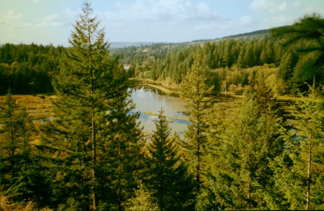
| View from High Knoll |
|
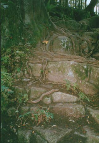
| A Natural Staircase |
|
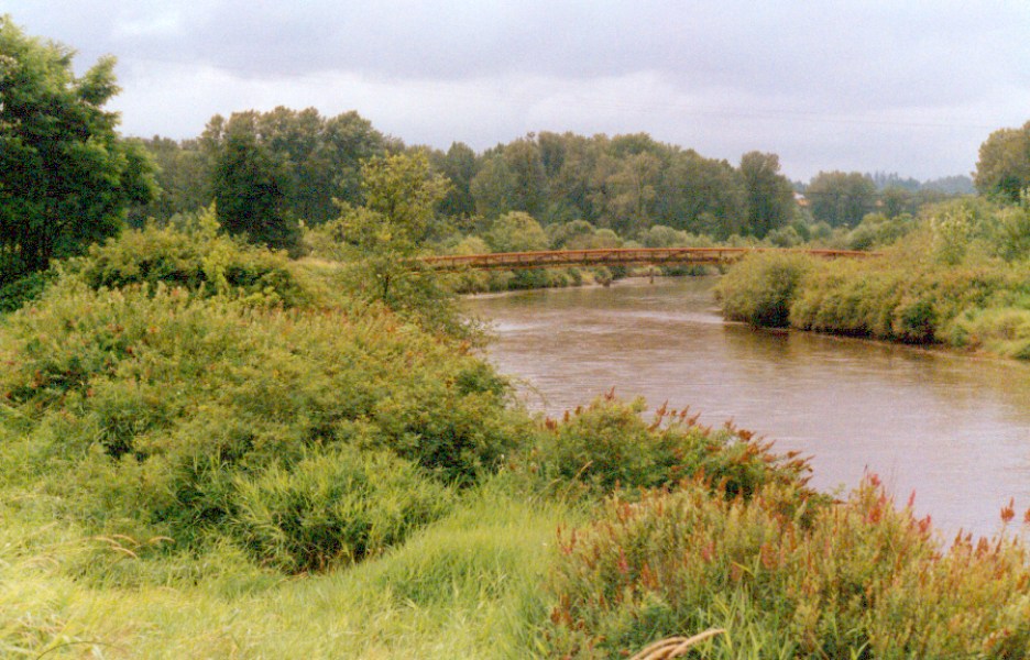
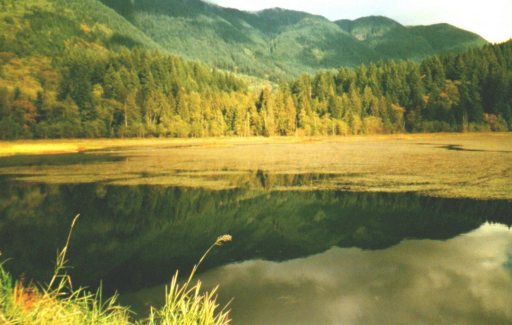
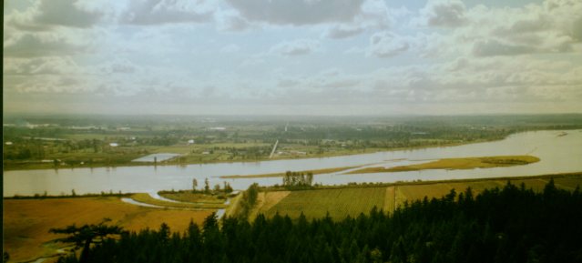
| View of the Pitt River |
|
Belcarra Park... Admiralty Point
Admiralty Point Trail
Distance 2.5 km.
Elevation Gain 100m.
Time 2hrs.
As with the Jug Island Beach Trail the time given for Admiralty
Point is very generous .These trails are good for the little ones or the older folks, and time should be taken to explore
all the stops along the way.
The start of the trail is at the south end of the parking lot.
There is a short service road which takes toy to the trail proper. A gentle incline up the hill brings you up above the beach
at Belcarra.Your first stop is Cod Rock 15 minutes in and to your right. From here you can look back at Deep Cove, see kayakers
passing, and maybe get a glimpse of a harbour seal playing in the water. Maple Beach is just ahead and has toilets
in case you need them. Next stop is Whiteshell Beach
a great place to do some beachcombing . Here you can find clam shells galore
, star fishes, small crabs and tide pools to explore.
Half an hour into the trail should bring you to Admiralty Point.
There is a sign that directs you to take a right turn with a short walk down to the water. This is a good place to soak up
the sun and have some good views of the inlet. Cates Park
is across from you and Barnett Marine Park
is to your left. Here too you have a small beach and rocky shoreline to explore. On a clear day you can see the Second
Narrows Bridge and downtown Vancouver
in the distance.
Pick up the trail once again Burns Point is another half hour away. The interesting part of this trail as it winds
along the shore are, a few remnants of old houses, where only a few bricks and flowers remain.
Burns Point will give you a view of the inlet all the way up to
Port Moody and is directly across from Barnett Marine
Park. Extreme care should be taken here and do not get too close to the edge of
the cliffs as there is a steep drop off. From this vantage point you can watch the traffic from the marina, see eagles and
seagulls looking for food and wave to the Tugs that travel the inlet.
Rocky Point Park- Shoreline Trail
Port Moody
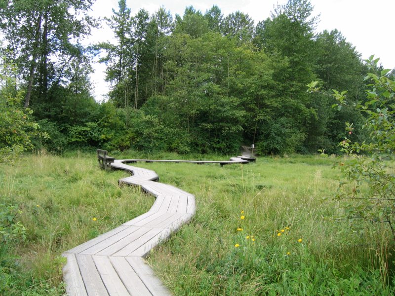
| Boardwalk arcoss the marshland |
|
Rocky Point Park; Shoreline Trail
Distance; 6km.
Time; 1 ½ hours
Elevation; N/A
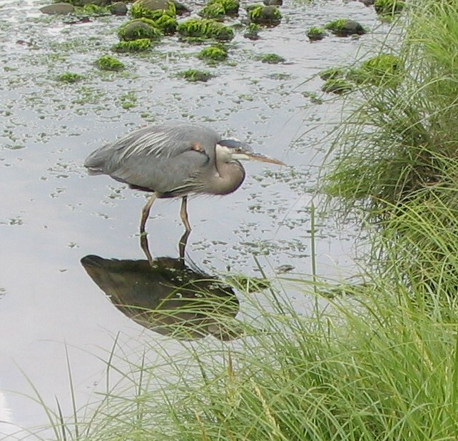
Rocky Points Shoreline Trail is definitely a birdwatchers paradise.
I recommend you do this trail in the early morning before the joggers and trail runners get out there. Here you have a good
mix of forest, marsh, and water views all within 3 km and ending at the beach at Old
Orchard Park.
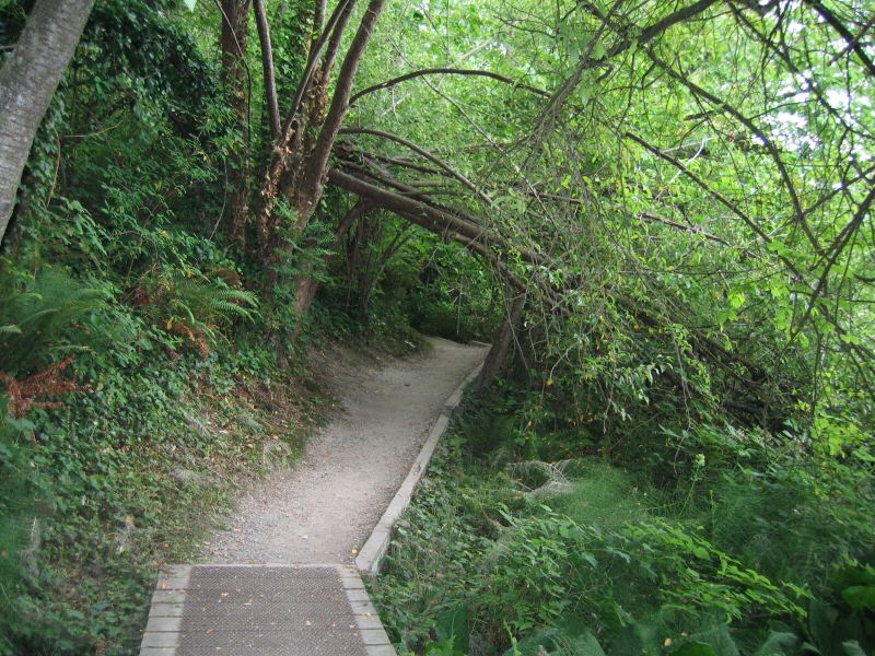
From the parking lot, go right along the paved path until you
come to the foot bridge. The trail enters the forest just after the bridge and is wide a pleasant to walk along. Keep an ear
tuned for the telltale knock, knock, knock, of the Red Headed Woodpecker and if you are lucky you can spot them on some of
the old tress along the way. Shortly to your left is a look-out over the marsh and boardwalk at the end of Burrard Inlet.
If you brought binoculars this is a good spot to watch unseen by the shore birds. Continue down the short staircase to the
boardwalk and over the marsh. Once you cross the two foot bridges you enter into the forest for a while with views of the
water to your left. The remains of the Old Mill are an interesting place to visit especially at low tide , and you can see
remnants of a bygone era when this was an industrial area. Following the gently rolling trail brings you out at Old
Orchard Beach and a good place to stop and relax
before heading back. This trail has an enchanting feel to it. The last time I was there I met a couple from Oregon.
They told me they almost expected to see some Hobbits pop out of the woods at any minute.
Rating 1 View
1
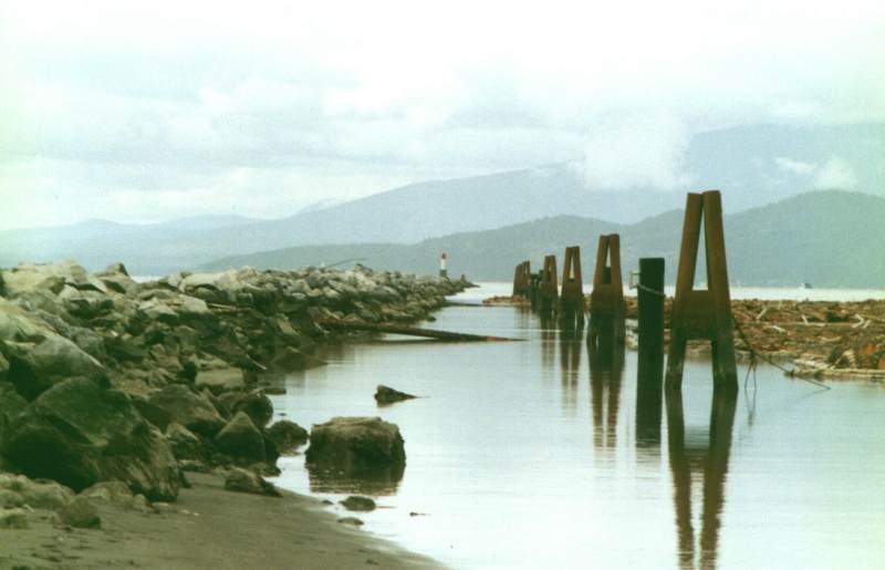
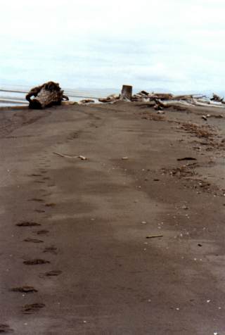
| Looking for dinner ? |
|
Vancouver Hiking
|