Hoover Lake Hoover Lake Trail : Distance : 3.7 km . Elevation 500 m. Elevation change : 250 m.Time : 1 \ 2 hours . To find the start of this trail , drive 20 km. out of Maple Ridge towards Mission . Stay on Dewdney Trunk Road . When you cross the Stave Lake Dam continue on the road for another 1 km. You will see the sign for the trail head on your left ,across from the Mission Landfill . The trail, a gravel road, starts out easy enough but soon turns into a steady climb. The average grade is 10% with a few of the hills at 12% .
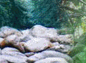
Stay on the main road and after 3 km . There is a sign for Hoover Lake to your left . The last 700m is through a trail that drops down through the dark forest .There are a few primative campsites at the lake and 1 outhouse . This is a small lake ,only 4 hectares and access to the lakeshore is limited .None the less it should make for a nice over-nighter and maybe a little fishing . Rating : 2 View : 2

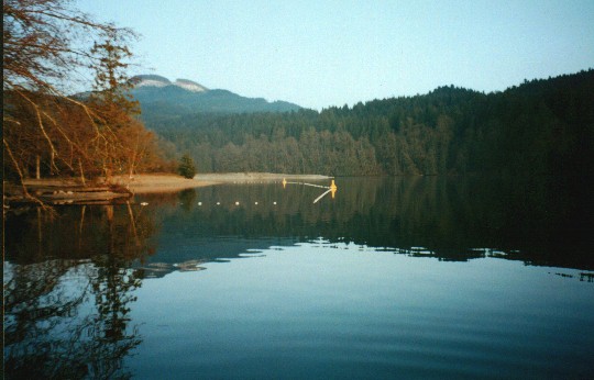
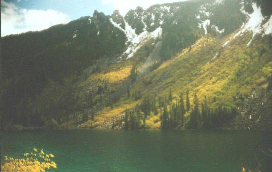
Lindeman Lake Lindeman & Greendrop Lakes - Distance : 4 1/2 - 10 km. Elevation gain : 400m. High point 1000m. Time : 2 - 5 hrs. To find these lakes take the Cultus Lake turn off from the 401 freeway & make your way to Chilliwack Lake Road . This road is just past the turn off for Cultus Lake . There is a steel bridge and a sign pointing the way to Sardis . Cross the bridge and turn right . You are now on Chilliwack Lake Road . The Vedder River is on your right . Stay on this road for about 38 km. ( 1 km. before Chilliwack Lake Provincial Park ) and look for a sign on your right that will be marked " Post Creek Campground " . This is a B.C. Forest Services campsite . You should find plenty of parking here . The trail starts by a small creek and takes you immediately into lush forest . This is a trail the whole family can enjoy . At one point there is an old log that crosses the creek , for the little ones this can be exciting . The last 30 minuets is a bit of a grunt but short rest breaks should take care of that . Lindeman Lake itself , is a fair size . There are a number of tent sites at the lake . The locals tell me they fill up fast in the summer . The trail continues along the east side of the lake and over a small boulder field . On the west side of the lake towering over you are some peaks called The Gargoyles . The lake is in a narrow valley so the views are great . At the far end of the lake is a boardwalk and a small beach . At this point you can continue your journey to Greedrop Lake . Follow the pink markers across a small creek at the north end of the lake . This will take you up the valley past an old rockslide . There are some old growth trees in the area and lots of nice little camping spots along the way . I went up here in late May and ran into snow , which prevented me from getting to the last lake . It was too bad because I only had 1 km. to go but the weather was changing quickly and it was
getting cold . I plan to do this one again in the fall when the trees start turning . Rating 1 1/2 -2 View 2
|