|
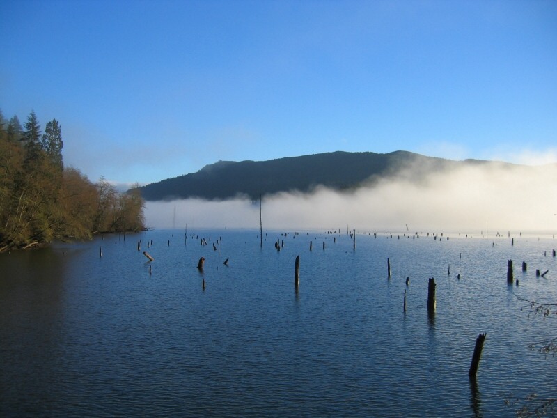
Hayward Lake
Hayward Resevoir Trail : Distance 1O km. Elevation Gain :minimal Time: 6 hours if you include the Railway Trail . Located
just 18km. east of Maple Ridge is Hayward Lake .
This lake was created by the Ruskin Dam .Just follow the Lougheed highway
past Maple Ridge
and take the first left, just before Stave river. Another way to find it is to take Dewdeny Trunk Road
to the Stave Lake Dam . Just before the dam you will see the sign for Hayward Lake . This is the best
place to park and
from here you can do either side of the lakeshore trail .This trail makes for a pleasent days stroll . This trail is also
a good trail for year around use . One interesting aspect of the east side trail is the floating walkway ,over Hairsine Inlet
. The walkway is 97m in lenght and is located 1km. from the Ruskin Dam . The east side of the trail is for hikers and the
west side is for hiking & biking . Good water views but it can get a bit on the muddy side after a heavy rain . Kids will
love this trail because of the many rest stops along the way , also there are a number of places to throw in the old fishing
pole . Rating 1 View 1 3/4
|
|
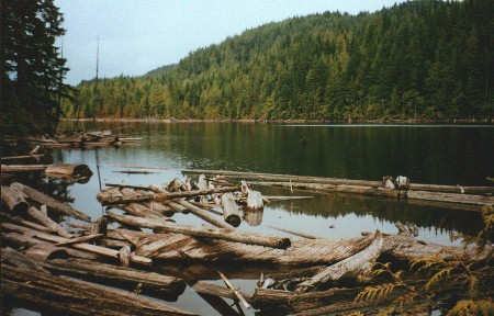
Hoover Lake
Hoover Lake Trail : Distance : 3.7 km . Elevation 500 m. Elevation change : 250 m.Time : 1 \ 2 hours . To
find the start of this trail , drive 20 km. out of Maple Ridge towards Mission . Stay on Dewdney Trunk Road . When you cross
the Stave Lake Dam continue on the road for another 1 km. You will see the sign for the trail head on your left ,across from
the Mission Landfill . The trail, a gravel road, starts out easy enough but soon turns into a steady climb. The average grade
is 10% with a few of the hills at 12% .
Stay on the main road and after 3 km . There is a sign for Hoover Lake to your
left . The last 700m is through a trail that drops down through the dark forest .There are a few primative campsites at the
lake and 1 outhouse . This is a small lake ,only 4 hectares and access to the lakeshore is limited .None the less it should
make for a nice over-nighter and maybe a little fishing . Rating : 2 View : 2
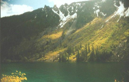
Lindeman Lake
Lindeman & Greendrop Lakes - Distance : 4 1/2 - 10 km. Elevation gain : 400m. High point 1000m. Time
: 2 - 5 hrs.
To find these lakes take the Cultus Lake turn off from the 401 freeway & make your way to Chilliwack
Lake Road . This road is just past the turn off for Cultus Lake . There is a steel bridge and a sign pointing the way to Sardis
. Cross the bridge and turn right . You are now on Chilliwack Lake Road . The Vedder River is on your right . Stay on this
road for about 38 km. ( 1 km. before Chilliwack Lake Provincial Park ) and look for a sign on your right that will be marked
" Post Creek Campground " . This is a B.C. Forest Services campsite . You should find plenty of parking here . The trail starts
by a small creek and takes you immediately into lush forest . This is a trail the whole family can enjoy . At one point there
is an old log that crosses the creek , for the little ones this can be exciting . The last 30 minuets is a bit of a grunt
but short rest breaks should take care of that . Lindeman Lake itself , is a fair size . There are a number of tent sites
at the lake . The locals tell me they fill up fast in the summer . The trail continues along the east side of the lake and
over a small boulder field . On the west side of the lake towering over you are some peaks called The Gargoyles . The lake
is in a narrow valley so the views are great . At the far end of the lake is a boardwalk and a small beach . At this point
you can continue your journey to Greedrop Lake . Follow the pink markers across a small creek at the north end of the lake
. This will take you up the valley past an old rockslide . There are some old growth trees in the area and lots of nice little
camping spots along the way . I went up here in late May and ran into snow , which prevented me from getting to the last lake
. It was too bad because I only had 1 km. to go but the weather was changing quickly and it was
getting cold . I plan
to do this one again in the fall when the trees start turning . Rating 1 1/2 -2 View 2
Vancouver Hiking
|